Between 1943 and 1944, the reconnaissance units of the USAAF, which later became the U.S. Air Force, meticulously documented the evolving landscape of England. These aerial photographs, predating the digital age of Google Earth, focused primarily on American bases in the southern regions. Now, over 3,600 of these black and white images have been unveiled in a freely accessible online map, curated by Historic England.
This remarkable collection of imagery provides a captivating bird’s-eye view of England during World War II and highlights the essential training that took place in preparation for bombing and reconnaissance missions over Nazi-occupied Europe. It showcases the impact of the war on the country, capturing U.S. military personnel playing baseball, ancient monuments surrounded by anti-tank defenses, and various towns and cities.
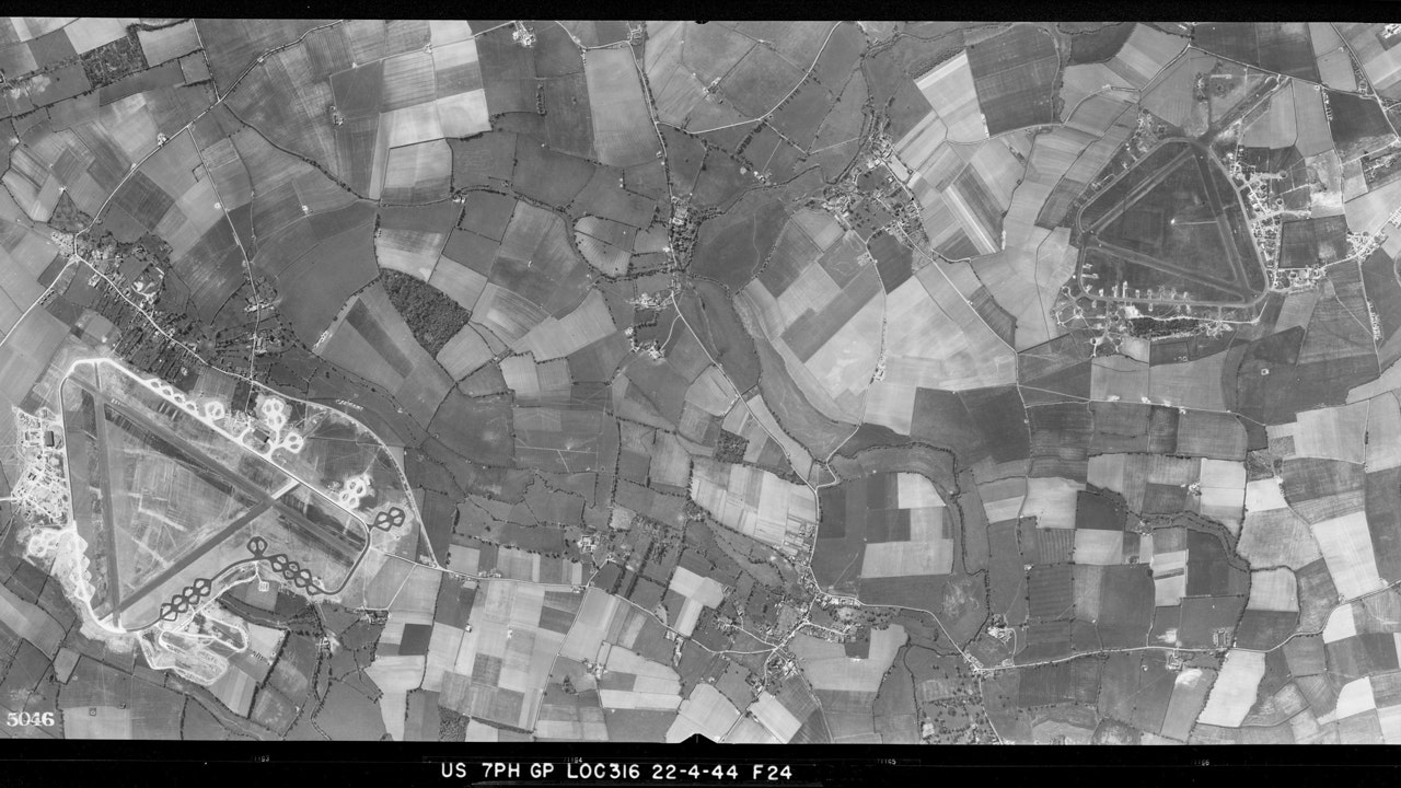
The collection prominently features the dozens of airfields built by U.S. forces, as well as the military camps and storage facilities constructed in the lead-up to D-Day. Notably, the photographs also capture the bomb damage at Manchester United Football Club’s Old Trafford stadium in 1941, making it one of the northernmost images in the collection.
“Our collection of USAAF wartime photographs were taken in England by the pilots and aircraft of squadrons that provided intelligence for the eventual defeat of Nazi Germany,” stated Duncan Wilson, Chief Executive of Historic England. “This came at a cost, with many pilots killed in the line of duty.”
During this period, the U.S. military presence in England grew significantly following the country’s entry into the war against the Axis Powers. Pilots flying reconnaissance missions took these photographs to gain the necessary experience for operations over Nazi-occupied Europe. The aircraft used by the reconnaissance units were specially equipped with fixed cameras and additional fuel tanks, replacing their guns and weapons. These cameras, equipped with various lenses and focal lengths, allowed for precise and comprehensive images of large areas, which proved crucial for the Allied forces as they prepared for the invasion of Europe.
“This collection of photographs serves as a testament to the pivotal role that aerial reconnaissance played in the Second World War,” added Wilson.
With the launch of this online map, individuals can now explore and analyze these historical photographs in great detail, shedding light on a significant chapter in England’s history.
Denial of responsibility! VigourTimes is an automatic aggregator of Global media. In each content, the hyperlink to the primary source is specified. All trademarks belong to their rightful owners, and all materials to their authors. For any complaint, please reach us at – [email protected]. We will take necessary action within 24 hours.
