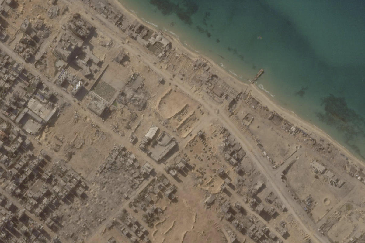
Israeli troops have made their way into Gaza City, traveling along a key coastal road on the Mediterranean Sea as part of their battle against Hamas, as per satellite imagery analyzed by The Associated Press this week. The images, released by Planet Labs PBC, depict a landscape marked by missile craters and smoke plumes from strikes on the northern part of Gaza City. The visuals also show previous positions of Israeli tanks and armored vehicles on one of three axes of attack used to isolate the city from the rest of the Gaza Strip.
Following a month of devastating war sparked by Hamas’ unprecedented Oct. 7 incursion into southern Israel, the city has seen a mass exodus of hundreds of thousands of people, with the conflict claiming over 10,500 lives so far, according to the Health Ministry in the Hamas-run enclave. While there have been delays in the release of imagery from Israel and the Palestinian territories due to concerns about potential misuse and abuse, Planet Labs remains committed to providing Earth observation data of Gaza to media and humanitarian organizations.
The latest images reveal Israeli forces positioned near the Shati refugee camp, a densely populated zone close to Gaza City’s center and home to Palestinian families displaced during the 1948 war. Witnesses in Gaza City have reported ongoing fighting between Israeli soldiers and Hamas, and footage released by both sides corresponds to features of the northern part of Gaza. However, the Israeli military declined to comment on the satellite images and its strategy in the Gaza Strip.
With Israel’s forces advancing from three positions, the clearing operations are expected to take weeks or even months to complete, according to the Institute for the Study of War. Notably, the satellite photos capture the movement of Israeli tanks and armored vehicles, a mosque in ruins, and numerous impact craters resulting from intense bombardment.
Gathering independent information about the ongoing situation in Gaza City remains challenging due to the restrictions on journalists. Satellite imagery from commercial companies has become increasingly valuable for reporting on such closed-off areas, providing highly detailed visuals that were once limited to a few countries. As the supply of satellite imagery grows, it helps offer critical insights for journalists and media outlets, enhancing transparency and accountability in challenging environments like the Gaza Strip.


