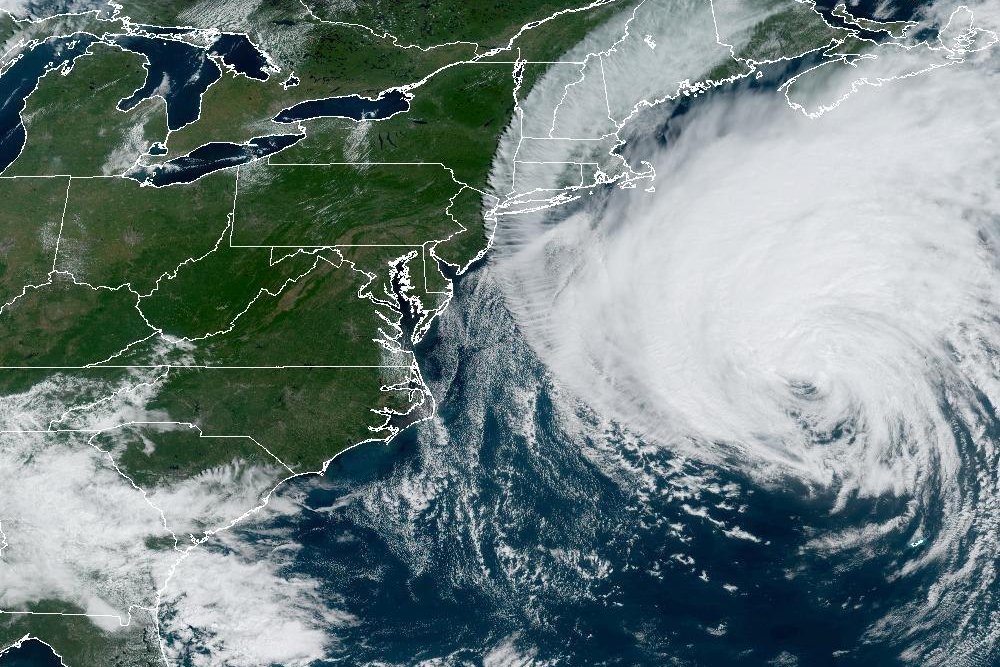

Calling Lee a “large hurricane,” forecasters at the National Hurricane Center said little change is expected in its strength but it is “expected to remain large and dangerous for the next couple of days.” Image courtesy NOAA
Sept. 14 (UPI) — The outer rain bands of Hurricane Lee began approaching southeastern New England Friday afternoon, hurricane forecasters said.
Meanwhile, the storm has moved far enough away from Bermuda that the island government has discontinued its tropical storm warning.
In its 2 p.m. AST update, the National Hurricane Center located Lee about 580 miles south-southwest of Halifax, Nova Scotia, and about 340 miles south-southeast of Nantucket, Mass. It was moving north-northwest at 18 mph and carrying maximum sustained winds of 80 mph, making it a Category 1 hurricane on the Saffir-Simpson Hurricane Wind Scale.
A tropical storm warning was in effect for Westport, Mass., northward to the U.S.-Canada border, Martha’s Vineyard, Nantucket, New Brunswick from the U.S.-Canada border to Fort Lawrence, including Grand Manan Island, and Nova Scotia from Fort Lawrence to Point Tupper.
Hurricane watches were in effect for New Brunswick from the U.S.-Canada border to Point Lepreau, including Grand Manan Island, and Nova Scotia from Digby to Ecum Secum.
“On the forecast track, the center of Lee will continue to move farther away from Bermuda and approach the coast of New England and Atlantic Canada through Saturday,” forecasters said in a statement. “Lee is then expected to turn toward the north-northeast and northeast and move across Atlantic Canada Saturday night and Sunday.”
Forecasters continue to warn that Lee is still expected to be “a large and dangerous storm” when it reaches eastern New England and Atlantic Canada.
Storm forecasters warned New England residents about possible wind strength that will down trees and possible lead to power outages across the region.
Also, the storm is generating intense swells across broad regions in the Atlantic, including portions of the Lesser Antilles, the British and U.S. Virgin Islands, Puerto Rico, Hispaniola, the Turks and Caicos Islands, the Bahamas, Bermuda, Atlantic Canada, as well as the entire east coast of the United States.
Forecasters said the swells and rip currents can be life-threatening.
Denial of responsibility! Vigour Times is an automatic aggregator of Global media. In each content, the hyperlink to the primary source is specified. All trademarks belong to their rightful owners, and all materials to their authors. For any complaint, please reach us at – [email protected]. We will take necessary action within 24 hours.
