
Studying the impact of climate change on Greenland’s ice usually concentrates on the ice sheet, which blankets about 80% of the island. However, until now, the multitudes of peripheral glaciers nestled along Greenland’s coastline have been largely ignored
Scientists have conducted a thorough analysis of more than 1,000 peripheral glaciers dating back from 1890 to 2022 using a blend of historical aerial photos and satellite images of Greenland. The findings are disheartening, showing that the rate of retreat of these peripheral glaciers has more than doubled over the last two decades.
Related: Satellites show Antarctic ice shelves have lost 74 trillion tons of water in 25 years
“Peripheral glaciers, although they represent only about 4 percent of Greenland’s total ice-covered area, contribute to 14 percent of the island’s current ice loss, a disproportionately large figure,” said Laura Larocca, a first author of the study. “Globally, all glaciers distinct from the Greenland and Antarctic Ice Sheet have contributed to approximately 21 percent of observed sea level rise over the past two decades. Thus, these smaller ice masses are a critical component of the sea level problem.”
Related stories:
– Greenland ice sheets are weaker to climate change than we thought
– 6 mysterious structures beneath the Greenland ice sheet
– 10 devastating signs of climate change satellites can see from space
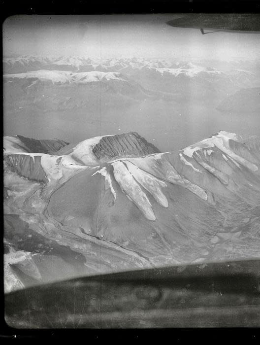
Examining historic aerial photographs of Greenland proved to be indispensable in the team’s analysis. Detailed observational records of these peripheral glaciers were once believed to be non-existent until the 1970s when Earth-observing satellites were launched. However, 15 years ago, an archive of old photos was discovered in a castle in Greenland, including images of the country’s coastline snapped by pilots in open-cockpit airplanes.
“Those old photos extend the dataset back prior to the satellite era, when widespread observations of the cryosphere are rare,” said Yarrow Axford, a geological sciences professor at Northwestern University. “It’s quite extraordinary that we can now provide long-term records for hundreds of glaciers, finally giving us an opportunity to document Greenland-wide glacier response to climate change over more than a century.”
