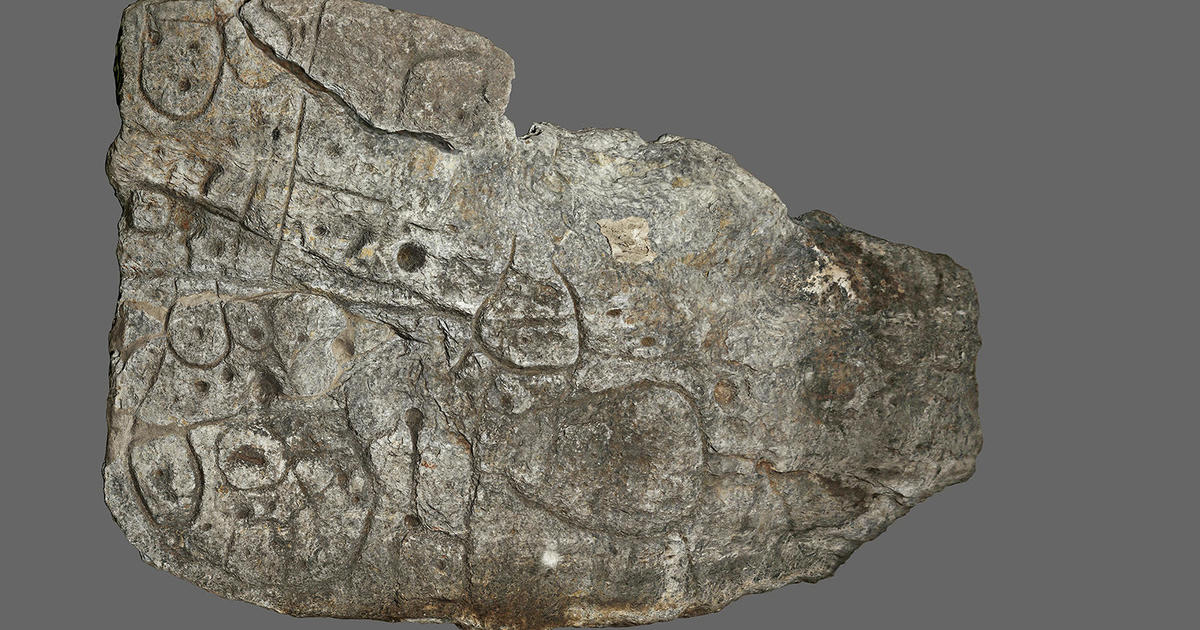
A piece of rock with mysterious markings that lay largely unstudied for 4,000 years is now being hailed as a “treasure map” for archaeologists, who are using it to hunt for ancient sites around northwestern France.
The so-called Saint-Belec slab was discovered at the site of a tomb and recognized as Europe’s oldest known map by researchers in 2021. Since then, researchers have been studying its etchings to help them date the slab and uncover lost monuments.
“Using the map to find archaeological sites is a unique approach. We have never worked like this before,” said Yvan Pailler, a professor at the University of Western Brittany (UBO).
Ancient sites are typically discovered through radar equipment, aerial photography, or by chance during construction, but the team is taking a different approach with this treasure map,” said Pailler.
However, the team is just beginning their treasure hunt.
The ancient map covers an area of approximately 30 by 21 kilometers. Pailler’s colleague, Clement Nicolas from the CNRS research institute, stated that they would need to survey the entire territory and compare the markings on the slab with current maps to make progress. He estimated that this endeavor could take up to 15 years.
“Symbols that made sense right away”
Nicolas and Pailler were part of the team that rediscovered the slab in 2014. Initially, it was found in 1900 by a local historian who did not understand its significance. The slab, along with a broken ceramic vessel typical of early Bronze Age pottery, was moved out of a burial chest. Since 1924, it has been stored in the collections of the National Archeology Museum.
French experts, along with colleagues from other institutions, have been working to decode the mysteries of the slab. “There were a few engraved symbols that made sense right away,” said Pailler.
By analyzing the markings on the slab, the researchers were able to identify the rivers and mountains of Roudouallec, part of the Brittany region. They compared the slab with current maps and found an approximately 80% match. However, they still need to identify all the geometric symbols and their associated meanings.
The slab is covered in tiny hollows, which researchers believe could indicate burial mounds, dwellings, or geological features. Understanding these symbols could lead to the discovery of new sites.
Before continuing their treasure hunt, the archaeologists have been excavating the site where the slab was originally found. According to Pailler, this site is one of the largest Bronze Age burial sites in Brittany. “We are trying to better understand the context of the discovery and establish a way to date the slab,” said Pailler.
In their recent digs, the archaeologists have already uncovered several previously unknown fragments from the slab. These pieces were likely broken off and used in the construction of tomb walls, which may indicate shifts in power dynamics during the Bronze Age.
The mapped area likely corresponds to an ancient kingdom that may have collapsed due to revolts and rebellions. “The engraved slab no longer made sense and was broken up and used as building material,” said Nicolas.
Denial of responsibility! Vigour Times is an automatic aggregator of Global media. In each content, the hyperlink to the primary source is specified. All trademarks belong to their rightful owners, and all materials to their authors. For any complaint, please reach us at – [email protected]. We will take necessary action within 24 hours.
