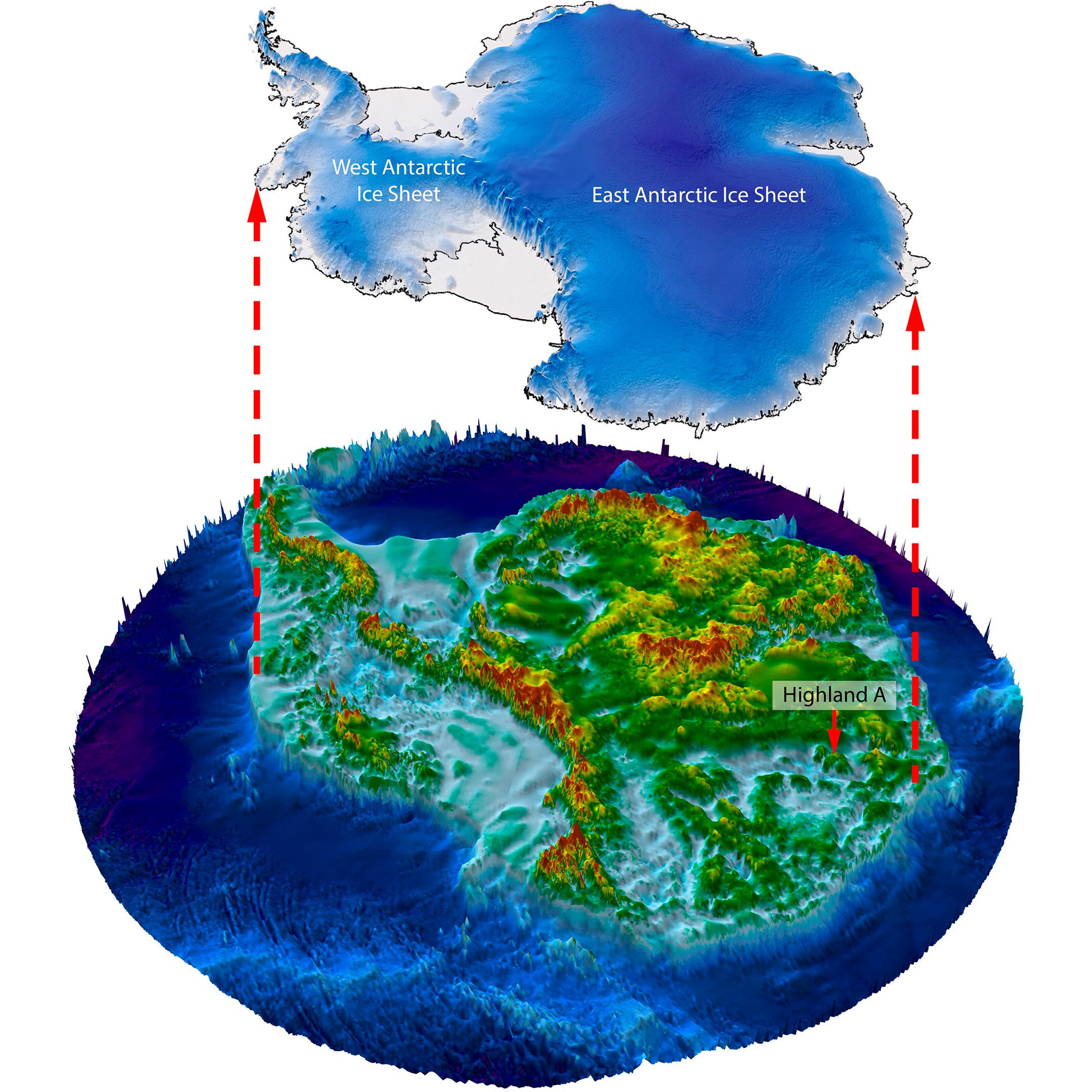
Scientists conducting the ICECAP data gathering project have made a significant discovery beneath the Antarctic ice. By utilizing satellite data and radio-echo sounding techniques, a research team led by Durham University has mapped a 32,000 km2 area of land under the vast ice sheet.
This mapping has revealed an ancient landscape shaped by rivers over 14 million years ago, potentially even pre-dating the initial growth of the East Antarctic ice around 34 million years ago. The discovered landscape consists of valleys and ridges resembling the glacially-modified landscape of North Wales, UK, in terms of size and scale.
The existence of this landscape suggests long-term temperature stability in the area investigated, shedding light on the behavior of the ice sheet in response to climate shifts. The findings have been published in the journal Nature Communications.
Implications for Climate Science
Professor Stewart Jamieson from Durham University’s Department of Geography, the lead author of the study, highlighted the significance of this discovery. He compared the knowledge of the East Antarctic Ice Sheet’s landscape to that of the surface of Mars, emphasizing the crucial role it plays in determining ice flow and response to climate change.
By examining a small part of this landscape in detail, the research team aims to gain insights into its evolution and how it influences the ice sheet’s behavior. They found evidence indicating that the land surface was created by rivers before the ice sheet formed, suggesting minimal change in this specific area over time. This understanding contributes to predicting the ice sheet’s response to future warming scenarios.
Research Contributions and Future Exploration
Neil Ross, a co-author of the study who is a Professor of Polar Science and Environmental Geophysics at Newcastle University, expressed excitement about the research’s culmination. He noted that this discovery reveals the early and long-term history of the East Antarctic Ice Sheet and provides valuable information for understanding its future evolution under climate change.
This finding builds upon previous work by the research team, which has successfully mapped hidden mountain ranges, canyon systems, and lakes beneath the Antarctic ice. Although the landscape beneath the ice sheet is not visible to the naked eye, small undulations on its surface captured by satellite images offer clues about the sub-ice landscape.
To confirm the existence of the landscape, the researchers employed radio-echo sounding from planes to penetrate the ice and map the underlying land’s shape. They believe that more undiscovered ancient landscapes likely exist beneath the East Antarctic Ice Sheet.
Professor Jamieson concludes by stating their ongoing commitment to exploring the landscape, filling in survey gaps, and using this information to deepen their understanding of the ice sheet’s history and changes over time.
Reference: “An ancient river landscape preserved beneath the East Antarctic Ice Sheet” by Stewart S. R. Jamieson, Neil Ross, Guy J. G. Paxman, Fiona J. Clubb, Duncan A. Young, Shuai Yan, Jamin Greenbaum, Donald D. Blankenship, and Martin J. Siegert, 24 October 2023, Nature Communications.
DOI: 10.1038/s41467-023-42152-2
The survey data collection supporting this work received support from the UK Research and Innovation’s Natural Environment Research Council (NERC), the US National Science Foundation (NSF), and NASA.


